Ralph, me, Jürgen at the WW1 bunkers and observation post.
 Starting the hike, L to R: Ralph, Me, Gail, Angelika, Jürgen.
 Day 53 - On The Border Of Italy and Austria
Chance of rain today, so we decided to all hike together. Veronika is hurt, so Agnes is going to take her to the doctor. The remaining five of us: Jürgen, Ralph, Angelika, Gail and I, pile into Angelika and Ralph’s car. With five packs and assorted boots, it is a tight fit.
We drove from Lienz back towards Italy, almost to the town of Sillian. We turned left onto the road #111, into the last valley system that lies just north of the Italian-Austrian border. You could easily do a couple day long road trip on this road, the villages are so eye-hurting stunning and the forested hills and fields so brilliant green. We followed 111 until we came to the village of Obertillach (which is “up valley” from Untertillach).
We drove on a little, one lane road that started out paved, but soon turned to gravel. Up and up the valley Ralph carefully drove, weaving back and forth around bumps while Jürgen checked the map. On the way we drove a small bridge over Gail Creek (Gailweg) so we got out for a photo. We kept on, until the road ended at a lake named Klapfsee. This is where we stopped to hike.
The lake is green, but not with moss or slime. It is just the water color. Set in the head of a beautiful valley, it runs long and narrow and is surrounded on three sides by mountains.
While everybody was putting on boots and adjusting packs, I wandered over to the hillside and suddenly spied…
Wild strawberries! I love wild strawberries. I used to eat them as a kid; I think the last time I had any was in Colorado, high in the mountains when I was in my early 20s. So I started picking and eating them, and the taste was so great! I offered some to the others, but they were happy with one each (Secretly I was glad about that! More for me!) so I just kept at it, gathering a nice handful to eat while we hiked.
Now I remember why I don’t like regular strawberries very much: they have such a lack of flavor compared to these.
We were going to start up the trail, but suddenly two families came running down the trail, because a cow was coming down the trail after them. This caused a ruckus as everyone scattered (and I went back to picking more berries). The farmer came over, very irritated and chased the cow over through a gate, yelling at us in general, “The cow is not a toy!”
Back up the trail. It is very green and bushy, and the trail is in pretty good shape. It is not steep at all, and easy to follow the blazes. It is hard to move along much, however, because of the stunning view back down the valley, looking at Obertillach. As we hiked, I found a red raspberry! It must have been the last of the season, so fresh and sweet and full of juice. This is turning out to be a great hike.
Up we walked, through the herd of cows, up further.
Up more, and on a ridge above us, in the trees, is a smoking chimney. A hut! Of course. It is the Porzehütte.
The Porzehütte, all blond pine and cuteness, is set on a beautiful ridge, right at the end of the trees, where the trail starts up over the Tilliacher Joch.

Looking out from the top observation post.
 One of the bunkers.
 The Tilliacher Joch is the mountain pass from this valley. Two things make this cool. First, we are on the Italian - Austrian border, so we will walk over into Italy and back. Second, this is again the front lines of the WW1 battles, and there are some sort of remnants up here.
Angelika decides to wait at the hut for us, so Gail joins her.
Ralph, Jürgen and I head up. The trail is well marked and it is easy walking. I am sweating, but not like the other day. We get near the pass, and there the trail has been built up with rock walls on what would have been a steeper cliff.
Cresting the pass, I look into Italy and there, just across the valley, are the mountains around the Tre Cime, where we were just a week ago.
Just.
Right.
There.
Sexton is down and to the right, though you can’t see it from here.
Sign announce in Italian and German you have reached the important trade pass from centuries ago, and there is a memorial to the war. A couple trails meet here, leading to various huts and mountains to climb. Above us we can see a wooden pole roof over four little walls, so we climb up to investigate.
An entire area opens up to us now. The little pole-roof building is an observation post, right on the ridge, looking out over both countries. Further up the ridge line is another, and further another and another.
Below there are two long stone and concrete buildings, built back into the rocky cliff, and there is a third we don’t see yet. The buildings and outposts are not destroyed like they were in the Tre Cime area, rather they are in somewhat intact shape. I mean they are standing and you can walk in them, see the rooms and look out the windows.
The buildings were the living quarters for the troops while they built and manned the post. As near as we can figure, there were rooms for about 20-25 people here.
It must have been brutal in the winter.
There is no glass in the windows, and only one still has the wooden frame, but there rooms are divided out and in one building we find old metal bunk beds, the old water tank up on the wall with gravity feed hose, and the remainders of the fireplace used to heat the rooms. In another building the bathrooms are still there; the old style, porcelain hole-in-the-floor type.
It is amazing to me to walk around and through the buildings and observation posts, trying to see what they saw, trying to feel the fear and sweat and imagine the hard work of building this all up.
I do, however, start to feel the cold they felt. It has clouded over and the wind really moves over this exposed pass. I shuck my pack and put on my fleece, and I am almost considering my rain shell as well (to cut the wind) but I find a sunny spot in a grassy lee, and just sit and stare instead.
Ralph, Jürgen and I just walk around, commenting on this and that, taking photos of each other. Really, it is hard to stop exploring.

The unit stationed here.

Inside one of the bunk rooms. Fireplace (left) gravity fed water tank with hose (middle) bunk beds.
 Sitting on the border of Austria (R) and Italy (L).
 I see these little white posts that look like memorial markers, and at first I ignore them, thinking they are memorials to individual soldiers or something.
By mistake I wander over by one, and notice the side says “1920.” It is right on the edge of the cliff; another two steps and I will have a very fast trip back into Austria.
And that is when I notice the “I” carved on one side, and the “Ö” on the other.
Of course!
I look back down the ridge, and sure enough, about every 100 meters is another white stone, perched on the edge of the cliff. Turning around I see them running up the ridge ahead of me.
It is the border markers, established and marked out in 1920.
DUH.
I try to get a shot of both sides of a stone using the panorama function on my iPhone (only semi successful; I’ll have to practice) and finally settle for sitting on one marker, one foot in Austria and one in Italy.
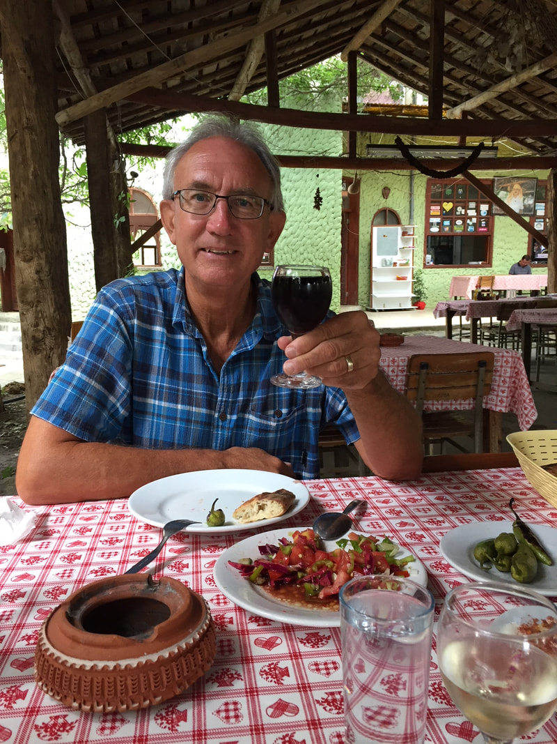
All too soon we head down, coats on, hands all numb, and make great time to the hut where Ralph and Jürgen have an apple cake dessert and I have a bacon knodel soup and a beer. Gail had half of her cheese left for me (yum!) and Angelika had the same apple cake dessert as the others.
We all sat around a while, laughing and talking, and I pulled out my iPhone and made a movie of an avalanche falling on Ralph and Jürgen (with the Action Movie app) to a lot of laughter. Then we made Angelika and Ralph change faces with MSQRD app and that was a hit. I have enough music and fun apps on my phone to entertain for hours.
We were all laughing until one of us noticed we had stayed too long and a rain storm moved in.
Crap.
The rain turned to hail, and so we were stuck. But, what do you know, the storm passed and we set out a half hour later, heading down the trail to the car.
We were all on our own for dinner, so Gail and I walked to the beer garden up the street. The owner had been out gathering mushrooms, so I had a meatloaf with mushroom gravy and rosti (hash browns) and Gail had sausages with mustard and bread. We each had a half liter of red/white wine, and Angelika and Ralph showed up later for a beer.
It was a great day and an interesting hike.
We head home in a week.
I am not sure if I am happy about that or not.
By mistake I wander over by one, and notice the side says “1920.” It is right on the edge of the cliff; another two steps and I will have a very fast trip back into Austria.
And that is when I notice the “I” carved on one side, and the “Ö” on the other.
Of course!
I look back down the ridge, and sure enough, about every 100 meters is another white stone, perched on the edge of the cliff. Turning around I see them running up the ridge ahead of me.
It is the border markers, established and marked out in 1920.
DUH.
I try to get a shot of both sides of a stone using the panorama function on my iPhone (only semi successful; I’ll have to practice) and finally settle for sitting on one marker, one foot in Austria and one in Italy.
All too soon we head down, coats on, hands all numb, and make great time to the hut where Ralph and Jürgen have an apple cake dessert and I have a bacon knodel soup and a beer. Gail had half of her cheese left for me (yum!) and Angelika had the same apple cake dessert as the others.
We all sat around a while, laughing and talking, and I pulled out my iPhone and made a movie of an avalanche falling on Ralph and Jürgen (with the Action Movie app) to a lot of laughter. Then we made Angelika and Ralph change faces with MSQRD app and that was a hit. I have enough music and fun apps on my phone to entertain for hours.
We were all laughing until one of us noticed we had stayed too long and a rain storm moved in.
Crap.
The rain turned to hail, and so we were stuck. But, what do you know, the storm passed and we set out a half hour later, heading down the trail to the car.
We were all on our own for dinner, so Gail and I walked to the beer garden up the street. The owner had been out gathering mushrooms, so I had a meatloaf with mushroom gravy and rosti (hash browns) and Gail had sausages with mustard and bread. We each had a half liter of red/white wine, and Angelika and Ralph showed up later for a beer.
It was a great day and an interesting hike.
We head home in a week.
I am not sure if I am happy about that or not.
 RSS Feed