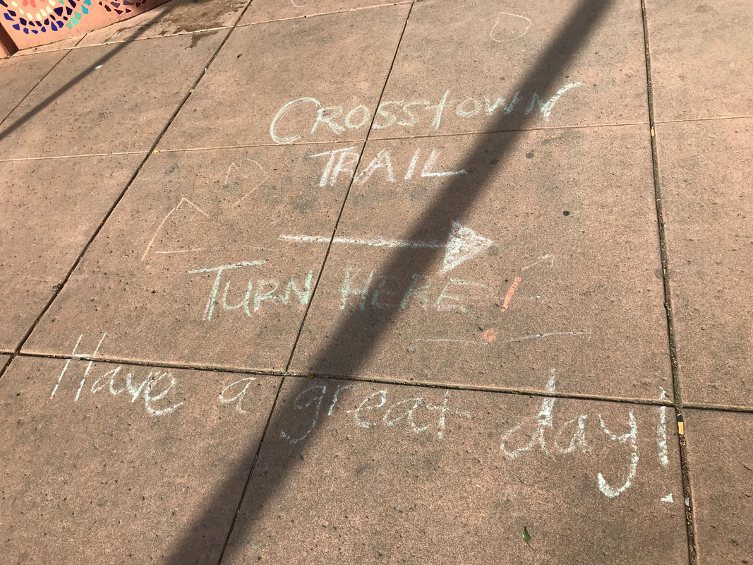
The website warns you that the trail is not marked. We did find one helpful hint along the way, however!
 The one and only official trail marker we found.
 Sunday, 16 February 2020
Our friends know we like to walk.
When we are in Europe, we are very inspired to return and ride our bikes everywhere... unfortunately "everywhere" is uphill from our house, and we are not really good bike riders.
But we can walk, miles and miles, and it doesn't bother us at all.
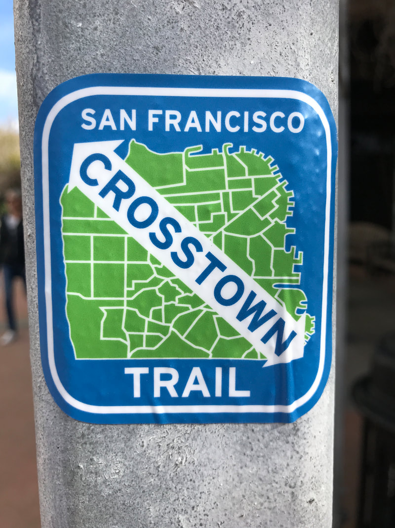
So when my good friend Aura heard about a new "trail" cutting diagonally 17 miles across San Francisco, she not only checked it out, but told me about it.
I found the information here, and then Gail and I started planning.
We are always up for a good walk.
And this was not a good walk, it was a great walk.
Our friends know we like to walk.
When we are in Europe, we are very inspired to return and ride our bikes everywhere... unfortunately "everywhere" is uphill from our house, and we are not really good bike riders.
But we can walk, miles and miles, and it doesn't bother us at all.
So when my good friend Aura heard about a new "trail" cutting diagonally 17 miles across San Francisco, she not only checked it out, but told me about it.
I found the information here, and then Gail and I started planning.
We are always up for a good walk.
And this was not a good walk, it was a great walk.
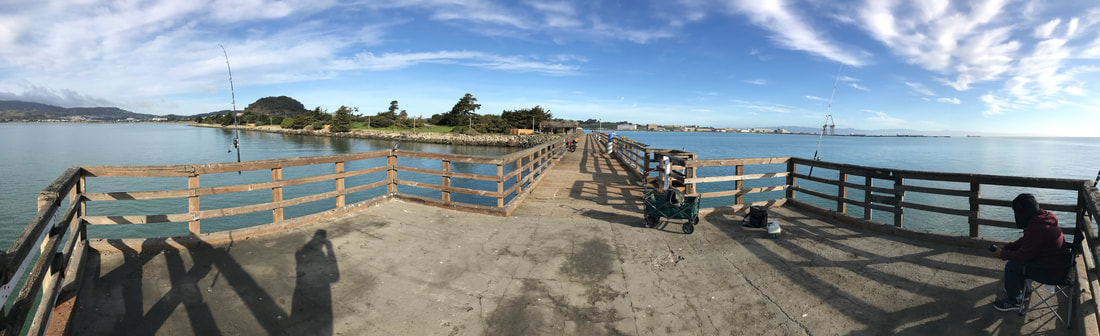
START: Out at the end of the pier: Sunrise Point, in Candlestick Point.
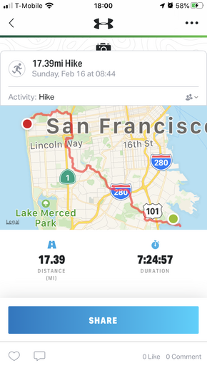 I use "Map My Hike" for accuracy. Click the photo to get the app.
 I am not going to give you all the details of the walk, or a step by step recounting.
Here is some general information about how we did it, and some pointers to help you.
You can walk North to South, or south to north. We started South which allowed us to (almost) see the sunrise, and ended North which did allow us to enjoy a sunset. Also I liked walking "into" San Francisco and enjoying the views, rather than walking with my back to the city.
Various websites state the length as 16 to 18 miles. You can see we walked 17.39 miles from where UBER dropped us at Candlestick Point, to the Lands End visitor center. We walked probably another quarter mile to the UBER pick up at Point Lobos Ave and 48th.
UBER cost us $14 to the trail start, and $37 back from the trail end, due to higher demand.
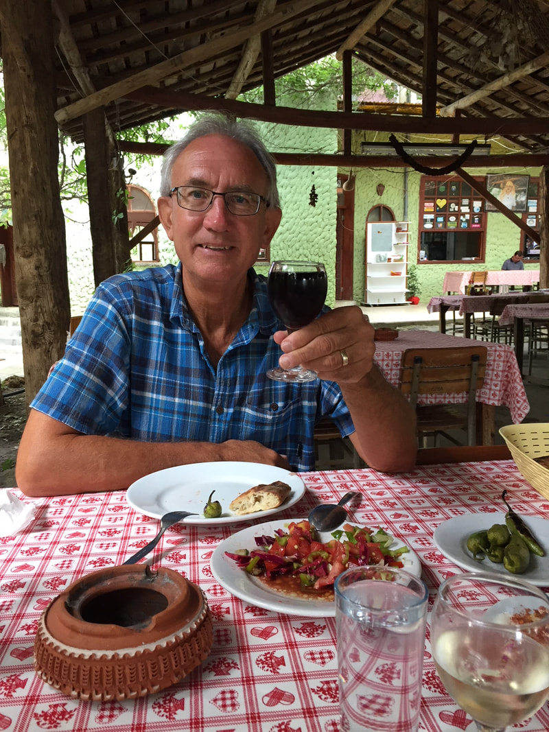
We started at 9:00 and ended at 17:00 with an hour out for lunch. We didn't "hike" we just wandered along talking and taking photos.
You can download an app from the website, but I found it to be useless (as did Aura a few weeks earlier). I printed out the three-page maps and the (hike northbound) cue sheets from here.
The cue sheets are essential.
We referred to the maps maybe three times total just to get an overview, but the cue sheets were the thing. Next time I would load the PDF maps on my phone, but print the cue sheets and simply follow them.
There was less food and fewer cafes available than I thought. Here is my suggestion: eat breakfast before the walk. Start with one bottle of water to share. It wasn't until about mile three or four that we came to an open mini-mart for water. Then for meals, you can count on this:
if you look at the three page map selection, there are a lot of cafes right at the end of map one and again right at the end of map two.
So you can reliably plan to eat about 1/3 or 2/3 of the way into the walk.
The cafe at Lands End closes at 17:00 so we missed out on a drink at the end. That was a bummer.
Here is some general information about how we did it, and some pointers to help you.
You can walk North to South, or south to north. We started South which allowed us to (almost) see the sunrise, and ended North which did allow us to enjoy a sunset. Also I liked walking "into" San Francisco and enjoying the views, rather than walking with my back to the city.
Various websites state the length as 16 to 18 miles. You can see we walked 17.39 miles from where UBER dropped us at Candlestick Point, to the Lands End visitor center. We walked probably another quarter mile to the UBER pick up at Point Lobos Ave and 48th.
UBER cost us $14 to the trail start, and $37 back from the trail end, due to higher demand.
We started at 9:00 and ended at 17:00 with an hour out for lunch. We didn't "hike" we just wandered along talking and taking photos.
You can download an app from the website, but I found it to be useless (as did Aura a few weeks earlier). I printed out the three-page maps and the (hike northbound) cue sheets from here.
The cue sheets are essential.
We referred to the maps maybe three times total just to get an overview, but the cue sheets were the thing. Next time I would load the PDF maps on my phone, but print the cue sheets and simply follow them.
There was less food and fewer cafes available than I thought. Here is my suggestion: eat breakfast before the walk. Start with one bottle of water to share. It wasn't until about mile three or four that we came to an open mini-mart for water. Then for meals, you can count on this:
if you look at the three page map selection, there are a lot of cafes right at the end of map one and again right at the end of map two.
So you can reliably plan to eat about 1/3 or 2/3 of the way into the walk.
The cafe at Lands End closes at 17:00 so we missed out on a drink at the end. That was a bummer.
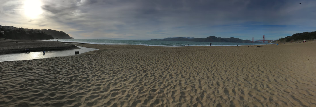
NOT QUITE THE END: but I liked this photo best. Baker Beach, two miles from the finish at Lands End.
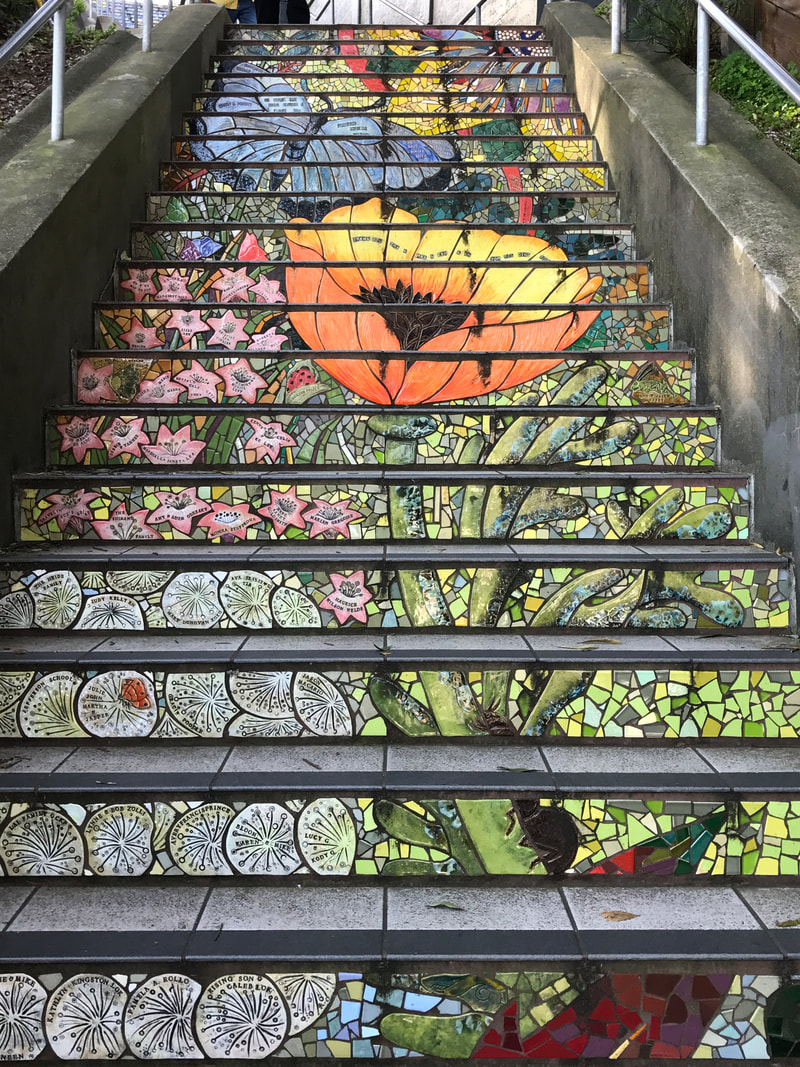 The "Hidden Garden" tiled steps, which I think are better than the more famous 16th and Moraga steps.
 This walk is a great way to see San Francisco. We have visited San Francisco probably 50 times, wandering through every part of the city, and yet this time we walked through neighborhoods I didn't even know existed, had great vista views across the city from a couple high points, and got to see some cool, "off the path" tourist highlights like Golden Gate Park, the Tiled Stairs, and Sutro Baths. We were surprised by the amount of open space, wooded parklands, canyons and open hilltops across this crowded city.
We were fortunate to have a sunny day; still I alternated wearing my fleece and feeling chilled to wearing just a T-shirt and sweating. Typical day in San Francisco.
So, you think you know San Francisco? I challenge you to take the trail and see a whole new city open up.
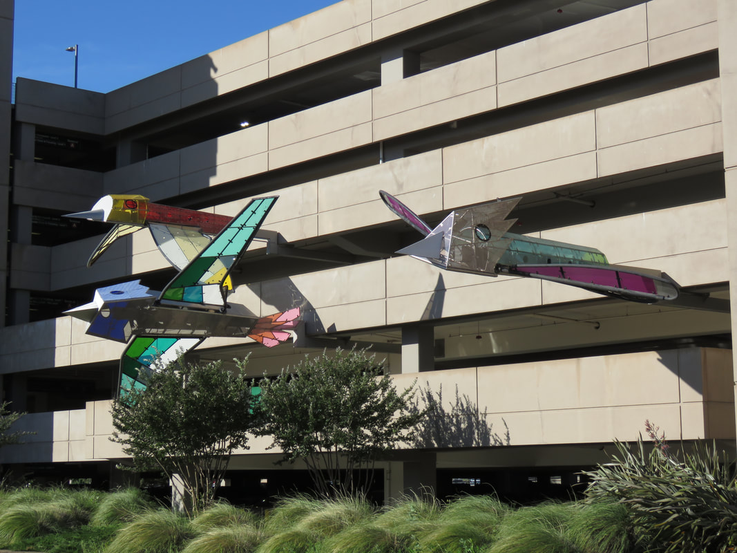
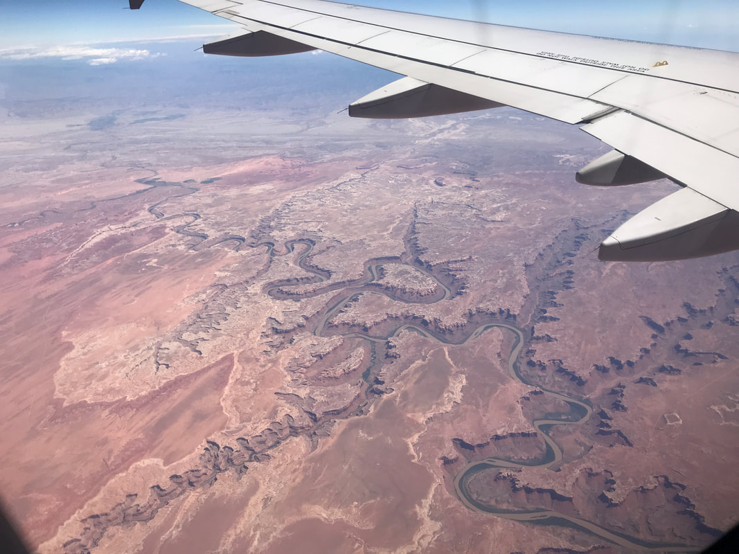
Check out the photos.
We were fortunate to have a sunny day; still I alternated wearing my fleece and feeling chilled to wearing just a T-shirt and sweating. Typical day in San Francisco.
So, you think you know San Francisco? I challenge you to take the trail and see a whole new city open up.
Check out the photos.


 RSS Feed