Note all the information on the sticker above the sign.
 Day 46
The mountain air was cool last night, and it was so nice to finally sleep well.
The sun rose, angry orange sky, then it quickly disappeared into the clouds.
The high peaks are hidden in the fog and mist, it will be interesting to see if we get above the clouds, or if we are hiking wet all day.
Our guesthouse is used to having hikers stay, so breakfast is waiting for us at 6am. I eat light, just a little meat and cheese and a plum, washed down with a couple cups of coffee.
Ralph and Angelika are right on time at 6:30, and we pick Jürgen up and leave his house by seven.
We are going to hike the ridges in the Hohe Tauern National Park, north of Lienz.
As we drive up, we hit a toll road. The access to the forest here is controlled by these tolls; rather than get a year pass like we do in the US, they pay a €3 to €7 toll on each trip. We are all digging around for one more euro, then Ralph plunks it into the machine and we have our pass.
As we drive up the well graded dirt road (no washboarding), we can look across the Lienz valley to the Lienz Dolomiten on the other side. Most people think of the Dolomite Mountains in Italy. That is the SudTirol (south Tirol). But we are in the ÖstTirol now, a lesser known area.
This really works for us; the villages are smaller, there are less hikers and tourists, and prices are low. In fact, as Americans, we are kind of a curiosity here. Our guesthouse doesn’t even have a listing on TripAdvisor, instead they rely on word of mouth, repeat customers and the few local website listings, primarily aimed at Germans and Italians.
Anyway, the goal is to get to a lake, named Swarzkofelsee (black peak, or black rock lake) then cross under the big Roßbichl peak. We’ll top the ridge, crossing a high pass and come out on top of Kugelkopf (Ball Head, but really more like a dumpling. A big, round dumpling head.), one of the higher peaks.
So the road leads us to a little mountain hut. This is called the Roaner Alm. The hut has bathrooms, food, and then about a fifteen minute walk over a small ridge, the competing Winklerner Hütte also has beds for rent.
In this part of the Alps, the huts seem to be about three to four hours hike apart.
We will start here at 1903 meters elevation (6234 feet) and make a big loop, gaining over 2,000 feet (600 meters) in elevation on the way.
As we start out, the clouds are breaking a little, though the sun is still obscured, and the mist and fog has lifted to reveal all but the highest peaks ringing the head of the valley, which have glaciers and snow on them.

It’s funny, but they measure the hikes in hours here, not in kilometers. No one has the faintest idea how many kilometers we are walking, just that the hike is listed as five hours, though these estimates can vary widely as we soon find out.
In fact, it takes our little group seven hours to do the hike. I would guess that we probably did about 12KM total during that time.
We start out following a dirt track across some grazing land, with cows and bulls scattered here and there. There is a sign as we cross the first fence, warning us that the cows have babies so do not disturb them, and pleas keep our dog on a leash.
The view across to the distant peaks is intoxicating, the walking easy on a cool day.
Gail and I are outfitted much lighter than our German and Austrian friends, partly because we are traveling light as always, and thus have no real “hiking gear” and partly because as a climber I have always been more of a low-tech, light and fast climber. We do not use hiking poles, and have only light weight jackets and shoes.
Our friends are concerned for us.
We start a gentle rise towards the treeline, then zig-zag up a little into the rocks. At one creek crossing the water is too deep and swift for Gail’s shoes, so I piggy-back her across, much to the amusement of all.

L to R: Ralph, Angelika, Gail, Jürgen.

Soon we are climbing steadily, following the red and white blazes painted about every fifty feet on rocks, posts, barns, whatever is available.
In my view, as an American hiker with years of experience backpacking, climbing and hiking, it would be almost impossible to lose this trail, even in a heavy fog. It is so well marked, and there are signs at every possible junction and even non-junctions that point the way to this hut and that, this lake or that one, and alternate trails.
It was like this in the Italian Dolomites, and when I was hiking on Mt. Blanc in France, and our hikes in the Swiss Alps, not to mention most other coastal and hills walks we have taken everywhere in Europe. It is just a real “user-friendly” system. If you just know the name, or the trail number, or even the blaze pattern you want to follow, it is easy going.
Soon we are above the treeline, and scrambling up a slope of rocks. The lake is up here somewhere, and we keep climbing steadily. The high peaks just ahead of us fog in, and as we come through the gap into the Swarzkofelsee basin it is sort of a mysterious feeling.
 Swarzkofelsee
 We top out at the lake, and take a short snack break. It is a pretty small, triangle shaped lake reflecting the rock slope of Roßbichl Peak above. Jurgen and I check it out, but the peak itself is listed as a technical climb.
Leaving the lake, we head across rock slabs and start to angle even higher. We pass an abandoned emergency climbers hut with a cross outside.
We are spread out, and I am bring up the back, which gives me a lot of time to linger and photograph and just think.
It is such a relaxing day, and the hike is interesting enough and on some of my favorite terrain, kind of mixed rock slabs and then open, high ridges with good exposure. At one point we are angling slightly up a very narrow path above a thousand foot drop off. These are the kind of hikes I am really comfortable with, and I make great time where others are edging cautiously along, so at times I am in front taking photos of the others coming up, then other times I linger towards the back, but all in all for me it is just a fun day.
I even have time to make a few rock stacks on top of the blazes.
Eventually we work our way up to a pass. The elevation here is 2520 meters (8268 feet) which turns out to be the highest point of our hike. Jürgen shares a cup of tea with me, and it tastes great as I admire the view. The fog has lifted and the peaks are once again in sight.
There is a little peak right at the pass, and so while the others work their way around below, I climb to the summit, which is the highest point near me.
Suddenly there is a shout below, and Angelika slips off the trail. Fortunately there is a ledge just below, and her feet are on it, but everyone is frozen for a second. I drop my camera and run down, climbing down the slope beside her, then behind her to trap and push her into the hillside as she removes her pack and hands it up to Gail. Ralph and Jürgen help pull her up to the trail.
All said, no harm done, just a scare, and so we continue on.

The trail follows along the ridge, swinging back and forth, and at times just running right on the top itself. It is a beautifully done trail, lots of exposure and good, long views. We drop and climb, climb, climb and drop, and then we are at the end of the ridge where it rises in a little knob, or ball. It is the summit of Kugelkopf, marked by a cross with a big edelweiss flower on it.
The elevation here is lower than the pass; we are at 2401 meters (7877 feet) and the view back over our starting point and the Lienz Valley is beautiful. We take a break to sign the summit register, and I discover something new to me: there is a rubber summit stamp with a worn-out stamp pad. I dig around for a paper.
All I can find is the emergency form provided by the guest house. (“You keep this part of the paper. They call me if you get hurt or die. So they know where you live with me.”)
I get what little ink I can onto the stamp, and THWACK! Make a very cool little reminder of the trip.
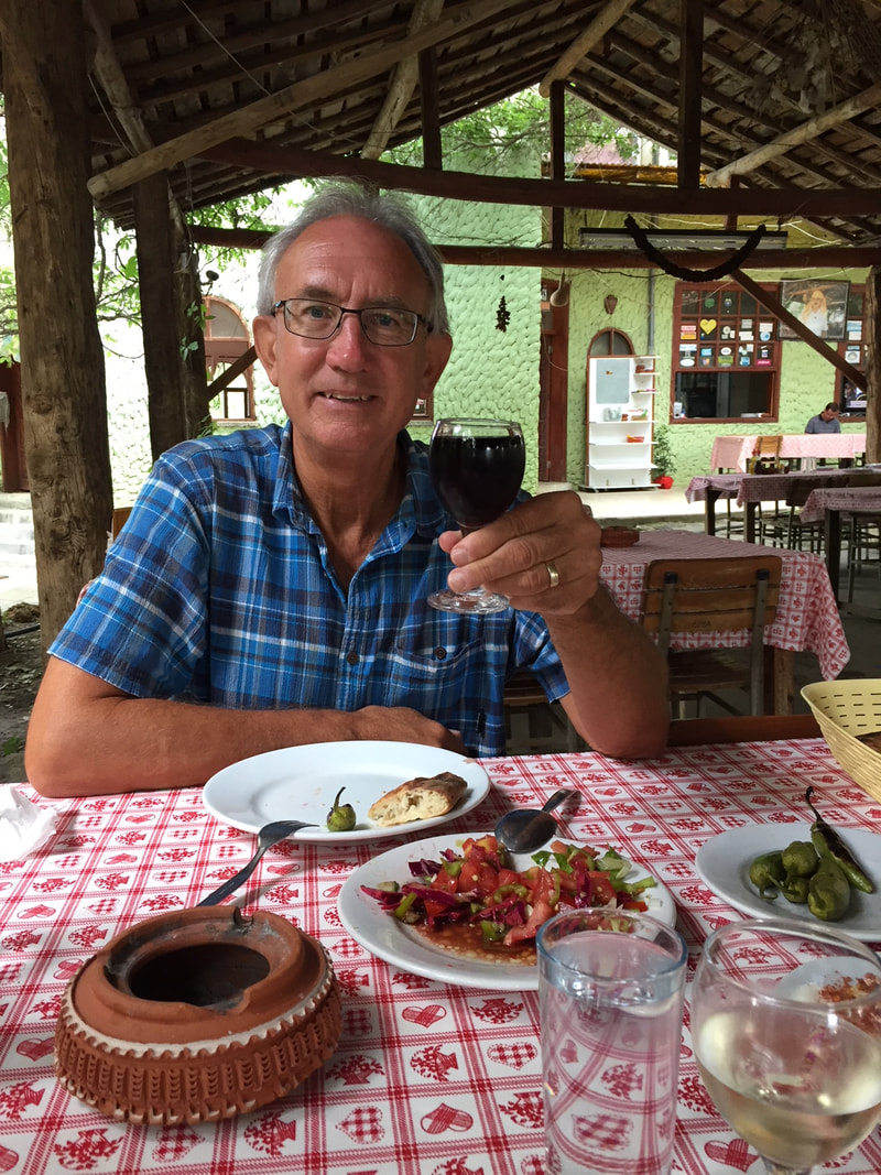
We work our way down the steep slope back to our starting point, at the Roner Alm hut, where we relax for an hour or two and eat. There is no menu, they simply cook whatever is on hand that day. Gail and I split a roast pork and potato meal, Jurgen has two dumplings with gravy. Angelika has hot dumpling soup and Ralph has a cold meat plate. Beers and water all around, and it is a fine way to wrap up the hike.
Back in Lienz, we drop Jürgen off, and then we are let out at the Tiefenbachers. We have an hour to clean up before we head back to Jürgen and Vrone’s house for dinner. This turns out to be a very nice get together, as two more friends, Martin and Monica arrive as well. Vrone is such a great hostess, and we are soon comfortable around the table eating a great chicken curry meal and talking.
After dinner Jurgen and Vrone’s son, Lorent, and his girlfriend Petra show up, and we start to discuss plans for Sunday. Everyone agrees to take Saturday off from hiking, but Sunday we are going to split into two parties. Half of us will take a nice hike, the other half will go climbing on a Via Ferrata route. We drink coffee, I show the day’s photos, and we sit and talk until 23:00 when we force ourselves to say goodbye until Sunday morning.
We sleep well again on a cool, rainy night.
The elevation here is lower than the pass; we are at 2401 meters (7877 feet) and the view back over our starting point and the Lienz Valley is beautiful. We take a break to sign the summit register, and I discover something new to me: there is a rubber summit stamp with a worn-out stamp pad. I dig around for a paper.
All I can find is the emergency form provided by the guest house. (“You keep this part of the paper. They call me if you get hurt or die. So they know where you live with me.”)
I get what little ink I can onto the stamp, and THWACK! Make a very cool little reminder of the trip.
We work our way down the steep slope back to our starting point, at the Roner Alm hut, where we relax for an hour or two and eat. There is no menu, they simply cook whatever is on hand that day. Gail and I split a roast pork and potato meal, Jurgen has two dumplings with gravy. Angelika has hot dumpling soup and Ralph has a cold meat plate. Beers and water all around, and it is a fine way to wrap up the hike.
Back in Lienz, we drop Jürgen off, and then we are let out at the Tiefenbachers. We have an hour to clean up before we head back to Jürgen and Vrone’s house for dinner. This turns out to be a very nice get together, as two more friends, Martin and Monica arrive as well. Vrone is such a great hostess, and we are soon comfortable around the table eating a great chicken curry meal and talking.
After dinner Jurgen and Vrone’s son, Lorent, and his girlfriend Petra show up, and we start to discuss plans for Sunday. Everyone agrees to take Saturday off from hiking, but Sunday we are going to split into two parties. Half of us will take a nice hike, the other half will go climbing on a Via Ferrata route. We drink coffee, I show the day’s photos, and we sit and talk until 23:00 when we force ourselves to say goodbye until Sunday morning.
We sleep well again on a cool, rainy night.


 RSS Feed