Day 49 Outside of Leukerbad, Switzerland
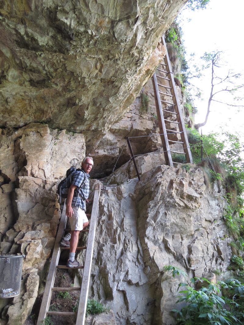
Ladders to Albinen.
The sun was out first thing this morning, so while Gail went to the Walliser Alpentherme and Spa for a facial, I packed up and went on a hike.
Actually, I strung two hikes together.
I started out walking back out of Leukerbad, along the promenade past the Torrent Lift, towards the village of Albinen. The canyon walls are steep here, and the path heads up and up to the base of the cliffs, where suddenly you are cut off.
Now, in the old days this made it impossible for the villages to trade efficiently. They had to follow the valley floor, along the river, and work their way up. So the villages were, for all intents and purposes, cut off from each other.
If they could just scale the cliffs, they could connect by a 6KM walking path…
So they did.
Using a series of eight precariously perched ladders, they worked their way up through a crack and connected the villages.
The ladders are still there. Here is the difference: now they are held in place with steel bolts and ties, and there are bolted wires along the way so you can clip in (like a via feratta) or use them as an additional “security” hand hold. The ladders are pretty stoutly built.
Still, this is not a hike if you are at all afraid of heights, or unsure of your ability to balance. Even the “trail” parts are very steep and narrow, and it is a long way to the valley floor below. Several memorials and crosses mark the places where people lost their grip, or their nerve.
If you want to walk to Albinen, but don’t want to do the ladders, there is now a tunnel bypass, along the road that connects the valley villages with the outside world.
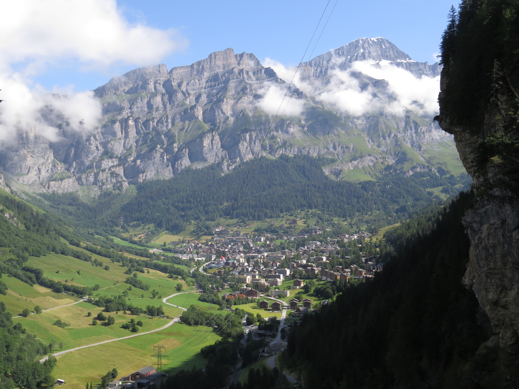 Leukersbad from the middle ladder.
 As I walked and climbed, I tried to imagine the first people who maybe tied rough ladders along this route to figure it out. Even with all the improvements on it now, I cannot imagine using it to actually haul bundles of goods and transport crops somehow… on their backs? Passing it along person to person? These people were tough and brave, perhaps desperate and a little crazy, far more ballsy than people today.
Anyway, I really enjoyed this part of the hike, and thought the views back to Leukerbad were really impressive. The walk through the woods along the cliff was peaceful, and I could hear the cowbells clanking in the meadows below me. Funny coincidence, when I topped out on the ridge above the ladders and narrow, steeps of the trail, the cathedral bells back in Leukerbad rang out, echoing through the valley. It was the call to mass. I sat and enjoyed the sound mixed with the roar of the river below and the banging-clanking of the cowbells. A truly “Swiss” experience.
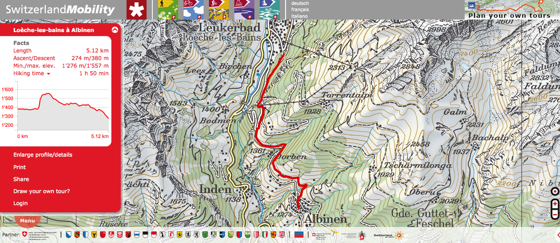
Here are three links about this trail: INFO 1 INFO 2 MAP
Anyway, I really enjoyed this part of the hike, and thought the views back to Leukerbad were really impressive. The walk through the woods along the cliff was peaceful, and I could hear the cowbells clanking in the meadows below me. Funny coincidence, when I topped out on the ridge above the ladders and narrow, steeps of the trail, the cathedral bells back in Leukerbad rang out, echoing through the valley. It was the call to mass. I sat and enjoyed the sound mixed with the roar of the river below and the banging-clanking of the cowbells. A truly “Swiss” experience.
Here are three links about this trail: INFO 1 INFO 2 MAP
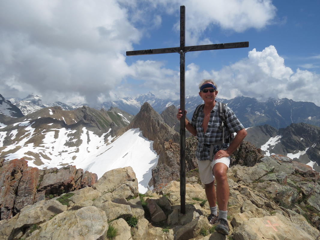 Torrenthorn summit.
 From here the path went up another 100 meters and I was at the Flaschen Cablecar’s lower terminal leading to Rinderhütte on the Torrent. I could complete the hike into Albinen, or I could take the lift up to the Torrent Ski Area hut/restaurant (called the Rinderhütte) and climb the Torrenthorn.
So, I decided that the second part of my hike would be climbing Torrenthorn.
I bought a one day pass for the lifts at CHF16 (a good deal I thought) and waited for the cable car. They do not run all the gondolas during the summer, so there is a wait between trips. I made the trip up with some other hikes, and a lot of mountain bikers, who ride the single track down and the cable cars up.
The Rinderhütte is at 2310 meters, and from there it is about 5KM and 600+ meter (2000 feet) elevation gain to the summit. (You can access Rinderhütte direct from Leukerbad by taking the Torrent Lift, which I passed on my way to the ladders.)
The trail follows an old dirt road, then turns into a dirt rut that you may or may not follow across hummocky grassy/flower/dirt and rock mountainsides, before hitting the bare rock up higher where the trail is more defined.
I started up at 11:00, in general following the western ridge, keeping the ski bowl to my right side. Parts were easy, other parts steeper, and a lot of the time I simply walked on the grassy areas rather than choose between the multiple rutted trails, working my way up. About halfway up, the ridge narrowed and I could look down into the valley and see Leukerbad, the valley rising above the town to the snow-covered pass and peaks at the head.
I crossed several snowfields, and worked my way up into the clouds passing over. When I hit a flat spot, the false summit, suddenly I had an almost 360 degree view. I could see the cross marking the summit, so I pushed on up across another snow field and through loose shale.
Less than ten minutes later, at 13:00 exactly, I was on the summit.
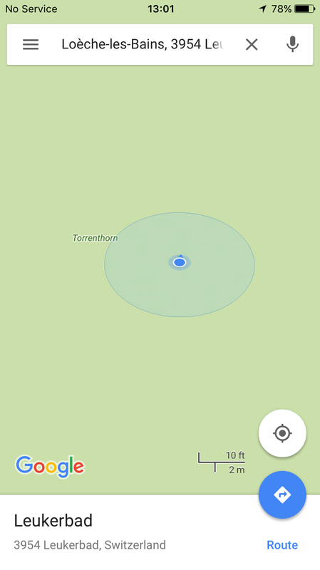 Accurate to within about ten feet.
 Torrenthorn is really not a big deal of a mountain. At only 2998 meters (9836 feet) it does not even make the coveted “3000 meter Peaks” list (not to mention it is 700 feet lower than Lassen Peak near my house, which I have summited over 50 times).
But, it is the highest, closest peak, and has a tremendous view. As the winds shifted the clouds here and there, I caught sight of Bietschorn (3934 meters) and Jungfrau (4158 meters) way in the distance.
I had been hiking pretty fast, so I was really hot and sweating, and decided to cool off a little while on the summit before heading down. I had time to look around and photograph some of the flowers, though I did not see a single Edelweiss on the entire hike for Gail.
The peak dropped off sharply about 1500 feet on one side but sloped more gently down the way I came. Down at the bottom of the cliffs was an emerald green lake.
The clouds were really sweeping over now, and occasionally I was totally fogged in, so I figured my time was limited.
I headed down at a pretty good pace, stopping once or twice to find the trail or markers, or any landmark in the thick fog.
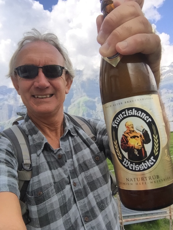
Under an hour later I was at the Torrent Gondola enjoying a cold Weissbier, waiting for the lift back to Leukerbad.
Within half an hour of coming off the summit, the rain started, followed by thunder and lightning.
When I returned, we grabbed our suits and headed over to the Leukerbad Therme for some warm water therapy.
They say the Swiss mountains are riddled with secret tunnels, gun emplacements and entire airstrips carved into the rock, fighter jets ready to defend the country. Almost every citizen is an armed member of the military, ready to defend this beautiful country. Well, I am here to report it is all true.
The tunnels and airstrips are so hidden that I haven't found one yet.
However, I had a great hike.
Here are two links on climbing Torrenthorn, in case you want to do this yourself:
The Hike The Map
I headed down at a pretty good pace, stopping once or twice to find the trail or markers, or any landmark in the thick fog.
Under an hour later I was at the Torrent Gondola enjoying a cold Weissbier, waiting for the lift back to Leukerbad.
Within half an hour of coming off the summit, the rain started, followed by thunder and lightning.
When I returned, we grabbed our suits and headed over to the Leukerbad Therme for some warm water therapy.
They say the Swiss mountains are riddled with secret tunnels, gun emplacements and entire airstrips carved into the rock, fighter jets ready to defend the country. Almost every citizen is an armed member of the military, ready to defend this beautiful country. Well, I am here to report it is all true.
The tunnels and airstrips are so hidden that I haven't found one yet.
However, I had a great hike.
Here are two links on climbing Torrenthorn, in case you want to do this yourself:
The Hike The Map
 RSS Feed