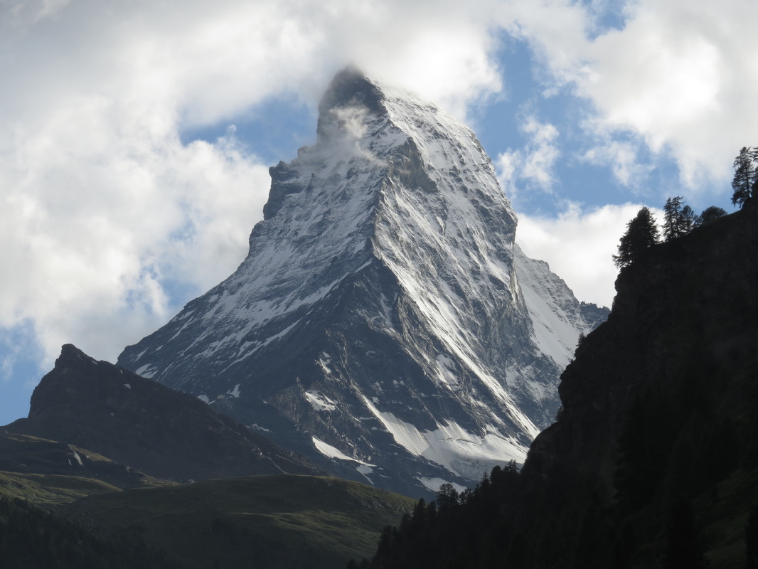
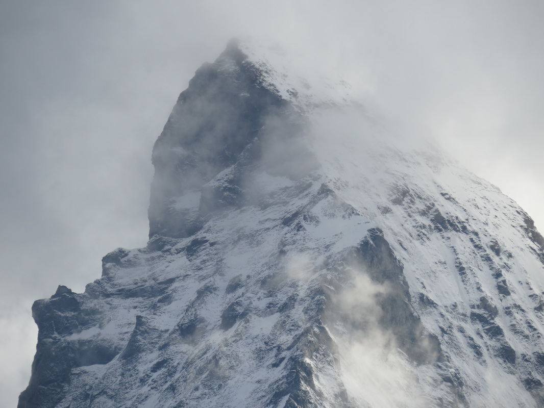
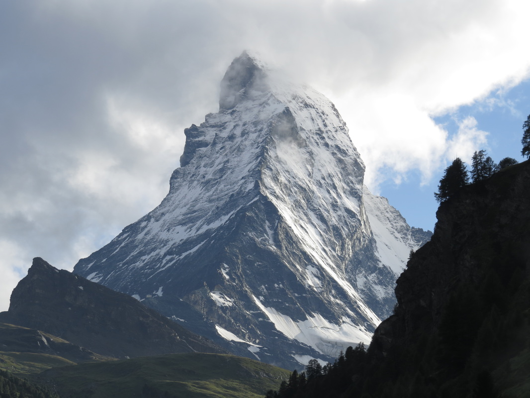
Suddenly, the clouds parted...
Less than one minute later the peak was completely gone.
These photos prove I wasn't hallucinating.
These photos prove I wasn't hallucinating.
|
|
|
|
Suddenly, the clouds parted... Less than one minute later the peak was completely gone. These photos prove I wasn't hallucinating.
2 Comments
Days 46-47 Zermatt, Switzerland 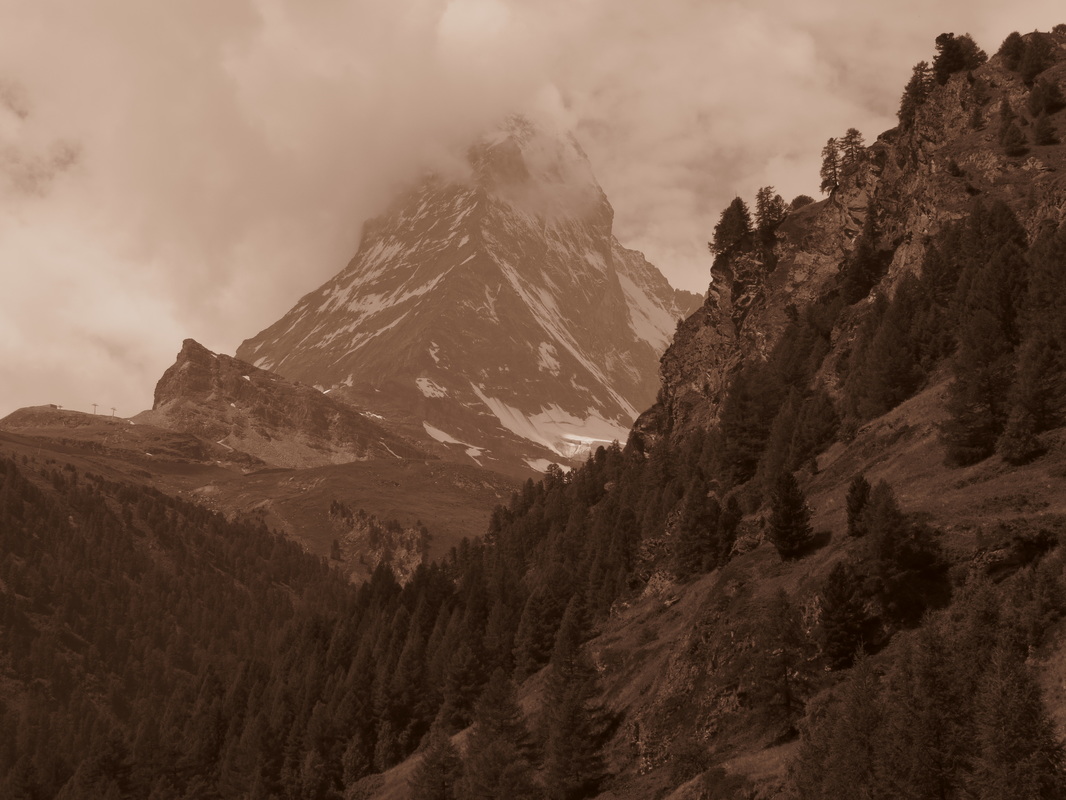 The Matterhorn. A ghost in the clouds. 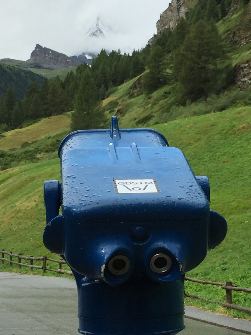 Unless that is a doppler-radar, X-ray vision scanner, there is no way to see the Matterhorn. Unless that is a doppler-radar, X-ray vision scanner, there is no way to see the Matterhorn. All your life you hear about a thing. Perhaps it is real, perhaps a myth. The Matterhorn. Invented by Walt Disney to excite kids on a roller coaster? Or a real mountain in the Alps? We have been to Europe for nine years now, hiking in the French Alps, Switzerland, the Italian Dolomites, the South Tirol of Austria, and the high peaks of Germany. Yet we have never laid eyes on the Matterhorn. Oh, we have been "in sight" of it, they say. "But it is clouded in." They say. Whomever "they" are. Perhaps it is a mythical creature. That is why we came to Zermatt. We hated to leave Sion, the lovely guesthouse and the wonderful hiking, yet were excited to head to Zermatt. We figured this would be our chance to stop and see this great beast. Till this trip, we have never come this way. Part of it is logistical: the Matterhorn and Zermatt are isolated up a deep valley. You have to go there, not be passing by. Part of it is the expense. As a resort town, Zermatt is one of the most expensive. The room alone for these two nights sucks up almost a week’s worth of lodging costs for us. When I planned this part of the trip, I looked into climbing the Matterhorn. By law, you have to have a guide. I figured I could ship my gear over, reserve a guide online… but when I looked into it, you have to go on several training climbs first before the two day big event. Again, the cost is prohibitive, at least if we are going to be traveling for an extended time. So, we are going to Zermatt with one goal: to see the Matterhorn. If we have time and the weather holds, we will go hike to a lake high on the Rothorn. We took a train 30 minutes up-valley to Visp. Visp has a very clean little train station with self-service luggage lockers, if you want to stop over and explore the town. We connected to an inter-regional train that took an hour to move up the side valley to Zermatt. As we headed to the Italian border, the canyon narrowed and waterfalls came off the cliffs. Old stone bridges arched gracefully and sturdy over a grey-blue river, rapid flowing glacier melt. Every house is a cute, wooden Swiss chalet, each village is adorable. The valley is deep, sheer rock cliffs on both sides. Old houses and barns have bleached skulls with antlers over the doors. It is bright green; the grass, trees, and flowers are everywhere. At Stalden we stopped in a village of tall houses, stacked up the hillside, every house decked with flowers overflowing from the balconies. The town is halfway up the mountain from the river, in a slightly wider spot. As we pulled into the village, a bright red gondola was descending to the station, looking like it would crash into us. It is like something out of a story-book. As we wound up the valley, huge snow covered peaks slid in and out of view, capped by clouds. We passed through St. Niklaus, waving to Santa as we passed through. The town itself is not as cute as the concept, however. By Täsch the river was grey, and glaciers peeked over the tops of the valley walls. There was more grey rock and less green trees, but the valley widened out a little. The Matterhorn never actually comes into view at all until you are actually into Zermatt. It is high on the right side. At least, it would be if we could see it. I suppose that is not fair. I can see the base, and to the summit on the right side at times. But it holds the clouds like a sweater holds fuzz-balls, they just cling and shift a little. We have a great room at the Alpen Rose, out at the upper end of Zermatt. We are right on the river, with a full-on view of the Matterhorn when it decides to show itself. The roar of the steel grey river drowns out any street noise we may have, and we have a clear view of the forests and valley. Fortunately for us, it is a great place to hang out. After we dropped our things, we walked out to see the town and get something to eat for lunch. We decided to have our big meal now, and stopped a few doors up at Restaurant Alpenblick. We sat under the yellow umbrellas and ordered, a deer sirloin steak with mushroom and bacon sauce for me, and trout, grilled in foil for Gail. I also ordered a starter of puff pastry in a mushroom cream sauce. The food was excellent, if very expensive, and in fact Gail says it is the best meal of the trip so far. I will say the venison was the most tender I have ever had, and the puff pastry really combined well with the wine, bringing out the earthy texture of the Pinot Gamay blend from Sion. As we ate, the song "Good Life" by One Republic came on, and I thought, "Yes it is." There is a real mix of modern wood and glass condo housing, with old original log and stone buildings. Some places they have lifted the original buildings to preserve them, and simply build around them. The main street through town is what you would expect, high end retail stores catering to tourists with trinket fetishes, and the outdoor crowd with top of the line, very expensive climbing, hiking, cycling and skiing gear. Every second place is a bar, but you can tell summer is the “slow” season here. The impression is that Zermatt is almost all condos and hotels, with more going up. There is an old fashioned band playing in the town square, an accordion, long horn, guys playing spoons and broomsticks. We found the laundry, and we can simply drop the bag in the morning and pick it up the same afternoon. With the river racing through town, and the mountaineering shops and focus on one single mountain, this reminds me a lot of Chamonix, France. Since we have such a great deck off our room, and had a huge lunch, we decided to eat in for dinner. A bottle of wine, a huge pretzel, a banana, and some Matterhorn chocolates and we were set. We watched the sun shift and finally set, but that mythical old beast, the Horned Matter, never did show itself the entire day. 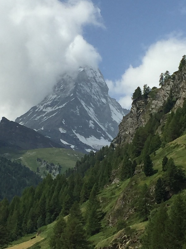 The Almost-Horn clings to the clouds. 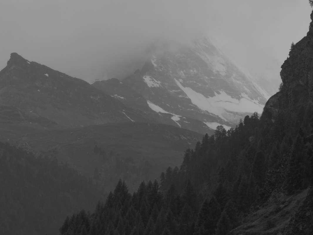 The ghost. The ghost. I was up early the second day, and the sound of the river seemed a little more intense. When I walked out onto our deck, I saw why: It was pouring rain. Not a drizzle. A full on gully washer. The clouds are low, very low, and the mountains all disappear. The plan for today was to take the train, lift and then gondola up and up onto the side of Rothorn, enjoy the high mountain views, and hike 20KM around some lakes on our way back down. But we ended up changing plans as the rain went on and on, and I realized it would be a waste of CHF80 each (ticket price for the train-lift-gondola, one way) to go hike in the fog. So, Gail slept in while I grabbed coffee downstairs, then took our bag of laundry to be done. The rain kept coming. As I walked back to the room, at 8:45 exactly, the first thunder boomed out, right as the cathedral bells struck. It is an awesome melding of sounds, the booming and rumble with the bing-bong-bong of the bells. The first three note of “Three Blind Mice.” By 9:30 the lightning is going of, and the lifts are stopped. It is raining so hard even the goats are staying in today. Here are a couple quaint and charming things about Zermatt. The goats. There is a herd of goats. Local goats. They live above the town at night, and go to pasture below the town during the day. The fastest way from home to pasture and back is right down main street. So, at 17:30 the goats are herded through town, and then they are taken back out to pasture in the morning. There is no real car traffic. Sort of. All the vehicles in town are electric. If you drive here, you have to park down valley, out of town, and shuttle in. Great idea. The taxis are electric little boxes on wheels, as are the police “cars.” The one bus that makes the rounds is electric, and so are the garbage and construction trucks. They sneak up on you at times, silent except for the whirrrring. Trucks are better because they rattle some. All the vehicles are pretty narrow, to fit through the streets. The ones I am most fascinated watching are these kind of sideways forklift trucks. Small, narrow, the forks come out of the side and lift whatever up onto the bed of the truck. So they park beside whatever it is that needs picked up, or beside the place to drop something. 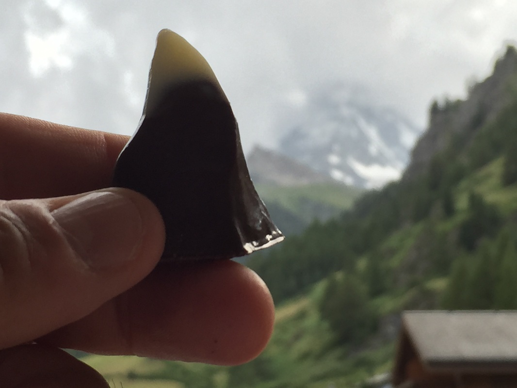 The Matterhornli The Matterhornli We ate lunch at Z'Art, which drew us in with the phrase, "Galerie Gastronomie.” The meal was very artistically done. Even the gas water was served in a flash with CO2 written on it. I ordered lamb ravioli with mushroom and peppermint. The ravioli was fantastic. Mint and lamb, what a great combo. It paired perfectly with the recommended Pinot Noir wine. The ravioli was stuffed with lamb, which melted in my mouth; the rest of the ingredients were i the sauce or layered on top. Gail got the mittagsmenu with salad, fish and dessert. Her salad was presented with an array of colors, perfectly weighted and in balance. It tasted as good as it looked. The fish was the lightest batter I ever tasted, on very fresh fish. With the lemon… perfection. I was so impressed with the food that I ordered a second round of chicken and curry wraps. I asked him to pair the wine, and ended up with a spicy rojo from Spain, a 2009 Merlot. The wraps were good, the curry not overwhelming. The wine was better by itself, rather than paired with the food. Gail's dessert was apricot compote with chocolate mousse, strawberry, mint leaf and apricot. I got a cafe espresso in a gold mirrored cup. It turned out that lunch was a gastronomic gallery. So we got out and walked between rain storms. Up the river, down the river. Part ways up a trail. Always carrying the umbrellas. We went in a few stores, hung out down in the little cafe attached to the hotel, and in our room. I bought a Matterhornli at the chocolate store: a little dark chocolate Matterhorn, topped with white chocolate snow, and filled with soft chocolate yummy stuff. We read and watched the BBC, Al Jazeera and CNBC. All the day the fictional Matterhorn was like a coy mistress, never fully revealing herself. Perhaps I’ll never see it. Perhaps it doesn't really exist. Day 45 Sion hike #3 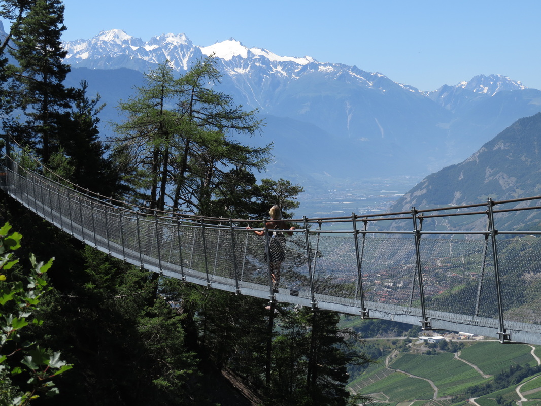 Gail, enjoying the free view.  This is a spectacular hike, and one of the most famous of the Bisses. Of the three, this one was my favorite. The photos speak for themselves. We headed out early in the day, but still there were many people on the trail. This is the bisse with 100 meter long suspension bridges and wooden catwalks hammered into the sides of cliffs. Add in a cave and some avalanche shelters, and it is a great hike. Originally built in 1430 by people with brass cajones, it has been rebuilt a couple times, then fell into disuse until it was restored to the hiking destination it is today. The web site states, "A very beautiful walk but absolutely not recommended for those suffering from a fear of heights.” It is gated off once the first snows hit, and is not opened until after the winter avalanche cleanup. So the open season is about June through October. There are informative signboards along the trail, complete with photos from the re-build of the 1800s. There are even a few small sections of the original Bisse, and you can see where they chiseled the holes in the rock along other sections. If you donate money to keep up a section of the trail, you get a big brass plaque with your name on it. The hike along the bisse is about 8KM one way (you have to hike back out again) not counting the approach hike and then, if you miss the bus back to town, the walk down. By the end of the day, we walked twenty miles.  Here is how we got to the start of the trail: You have to check the bus schedule the day before. There are only four times a day that the bus takes you all the way up to the trail; if you miss the connection it adds another 45-50 minutes of uphill hiking to get to the start. (As you will see, this is why we walked back to Sion in the end.) On this day we took the 8:03 PostBus #341 to Savièse. (The next bus leaving that made the connection was at 10:00, then twice in the afternoon.) I told the driver we wanted to go to the Prafirmin Torrent-Neuf stop, so he sold us the through ticket for CHF 7,60 each. The 341 bus took us up and up, through the beautiful village of Savièse to a stop in the woods, where PostBus # 343 was waiting. We walked off one, onto the other, and the second driver took us (the only two on the bus) up to the final stop at Prafirmin Torrent-Neuf. We were dropped off at this stop at 8:36. The bus ride again was worth it just for the tour and views. We started walking at 8:40, following the big brown Torrent Neuf signs. It was easy. We made it to the end of the trail at 11:15 (2 hours 35 minutes) and that included a lot of wasted time taking photos and more photos and more photos. At the trail’s end there is a little cafe. We had a sausage (the other choices are a cheese, or a foie gras) and shared a half-litre of white wine before heading back. Stopping to enjoy the moment is what caused us to walk back into Sion. If we had not stopped to eat, or if I had not taken so many photos, we would have made the return bus which runs at 13:05. We would have been at the bus stop at 13:20, except when we realized we’d miss it, we took the more direct route home.  Why walk two hours down to Sion? because the next bus along is at 17:51, and we were back in SIon, with delays and stops, by 16:30. No big deal, it was a great day for a walk. *Point of information: the 343 bus down runs at 6:48, 9:09, 13:06 and 17:51. Weekends only at 9:11, 13:07 and 18:11. You also have only four chances a day (three on weekends) to catch the compete connecting ride up. Ask around at the bus station the day before, or try using google maps, public transportation. Back to the hike. We were following the Torrent-Neuf signs. When you are dropped off, you are not yet on the Bisse, you have to hike to the start of it. It is maybe 2KM, and starts out with a nice walk along a road, then into the woods for a section. Once you hit the woods trail, you are on the Bisse, though there is no water flowing in parts of it. After about 5KM or so, you come to the St. Marguerite Chapel. This is where everyone gathered to pray that god or Mary or Jesus or anybody would keep them from falling off the cliff that day. I think they were very relieved when rope was invented. There are a couple interesting paintings inside the chapel, including one of Mary standing on the wooden walkway, looking serene. There is a cafe here by the chapel, but we did not stop since we did stop at the end cafe, called Refuge du Brac. It is from this point that you go through the gates, and turn onto the path along the vertical cliffs. This part through the canyon is about 5KM in length. The wooden walkways and water channel are pretty cool, the suspension bridges swaying over the void are just plain fun. Yes, you can sway and bounce on them. The views are outstanding, the drop-offs sheer and Wile E. Coyote deep. You are walking across the northern side of Prabe Mountain, and the Bisse draws water from the Morge river raging far far below. Near the end you come to the Notre Dame Chapel. There is a rope, so I rang the bell. Always wanted to do that. Ringing the bell. So, we lingered at the cafe and left at noon. As I said, we missed the bus by fifteen, maybe twenty minutes. So we decided to walk back to Sion, or at least low enough to get to a #341 bus stop. Let me tell you, it is a long way to the 341 bus stops. By the time we were that far, we just decided to go all in on the deal and walk home. The first part of the walk down was through forest, on a single lane road. We dropped into the village of Savièse, and stopped at a bar for a bottle of water with ice. That was probably the best drink of the trip so far!  Then something interesting happened. We were just walking along the road, and this old farmer type guy was standing out in front of his house. We came sweating by, and I nodded to him. He rattled something off in French, but for some reason I responded in German. Suddenly he perked up. I mean his face lit up, he straightened up, and became very animated. First he asked what we were doing, and when I explained that we were heading down to Sion from the Torrent Neuf, he shook his finger and said it was too hot hiking on the road in the sun, why don’t we take this water ditch trail instead? He pointed, and I looked, and sure enough, running right down the edge of his property was another water ditch and trail. “Zur den grosse kirche, geht links…” OK. I have it. A nice shortcut, and in the shade. Well, we talked a few pleasantries, and he was surprised to find out we were from California. As I thanked him and we made to head down the hill, he suddenly looked at e and said, “Machen Sie ein photo?” Well, yes as a matter of fact. I’d love to take a photo, thinking that he must have a good view from his back yard (since we were still high up on the mountain). But, in fact, he walked over to his very big garage (which was huge but somehow I hadn’t seen it until now) and opened a very big door, and my eyes about popped out. Inside were three beautifully restored old busses. You know, the 1930 type busses you see in old posters of the Alps. Two old yellow ones, and a special looking blue one. But we focused first on the yellow ones. They are from the 1030s, all Swiss made, but one with a British drive (left handed side). We got to poke around and sit in them. Then we moved over to the blue bus. It was the same thing, but he restore it and turned it into a camper. It was amazing; tables and chairs and even two little chandeliers… beds for four, a bathroom, wood ceiling… and the amazing part was that he restored these busses from the frame up. We stood and looked at his photo albums. He used to take his family camping, and sometimes they would meet with other campers who restore the same type busses, kind of like a Harley or Miata group. But his wife died a few years ago, and so now it just sits here. I could tell he comes out and sits in it to drink wine once in a while. Seriously cool. I wanted to offer to buy it from him right there, but the reality was that even if I bought it, how would I get it home? So, I just stared with my mouth open and thought once again, you just meet the most amazing people, in the damnest circumstances. Sweartogod, I could not make something like this happen in a million years. One other interesting note. On the wall of his garage, high up, was a skin. Kind of like a bear skin rug, but… But it was a dog. A Saint Bernard. I had to ask. Yes, his dog. It was a great dog. His sister fell in the mountains, broke her hip. he laid down with her, kept her safe and warm and saved her life. When he died in 1955, well, they saved him. A great dog. Still shaking my head in wonder, we shook hands and headed off down the trail. At the great church we turned left. Soon we were walking through the vineyards, then into town, and back to our guest house. So, we missed our bus back and had to walk. It was a great hike. Want to go hike it? Here are four websites with information about the Torrent Neuf: One Two Three Four Day 44 Sion hike #2   For our second day’s hike we decided to do the Bisse de Bitailla, one of the oldest ditches, built before 1307. Think about that. Over seven hundred years ago, and still in use. We could not get directly to the Bisse itself, so we ended up hiking along a mountain trail, and another Bisse along the way. The Bitailla itself is pretty short, maybe 10KM, but by the end of the day we put in over eight miles total. Here are the logistics to get to the start of the hike. We went to the train station to catch a yellow CarPostal (Post bus) Bus, # 354. It leaves pretty much every hour, at hour:20. We were heading up through Ayent, to the stop called Anzère Télécabine (Anzère ski area gondola). There might be a second bus up that goes on the hour:50 but through a different town, Arbaz. I am not sure. I just went down and asked the driver if he was going to the gondola, we took the first bus that did. It cost CFH 10,40 each and took about 35 minutes. The ride itself was very cool, well worth the money just to see the views and sights. Here is a good website with information on the trail. The hike is located in the Sionne valley to the right of the Rhône above Arbaz and Ayent. Here is a map. Here are the trail notes that we followed to do the hike. I copied them from the website above, and added a couple clarifications of my own in RED. From the gondola station (post bus stop), head west to Le Gô. When you get off the bus, stand with your back to the post and look uphill, left, across the parking lot. You will see the trail sign that points to Le Gô. After a short ascent along a forest road you will reach a clearing. Follow the road for another 100 metres and then follow the sign-post for «Les Evouettes». Take care not to follow the mountain pasture road! You are on the road already. Just follow it. The road climbs to a new clearing approximately 100 metres wide. Continue to follow the road on a slight incline for about 1 km. You should still be facing west. Then the road descends into the forest and at the first sharp bend turning south, take the forest trail which continues west. After a descent of about 10 minutes, the path turns north-west and crosses the western slope of the Sionne valley. Continue until you reach a mountain pasture road and make your way uphill along this road for about 1 km to reach the bisse at Les Evouettes. This is the part of the road where the river comes down and meets the road. The trail sign is on your left, before you get to the river. If you go past the river you will see a different trail which is not the correct one. In the beginning, the bisse is piped along the Sionne. You are walking on the trail, but without the water ditch next to you for about a half mile, or 1KM A few hundred metres after the avalanche bunker, looks like a weather station, on the left, about a half-mile down the trail as noted above the bisse resurfaces. Follow it until you reach the road to Anzère and head towards «Etang Long». This is the pond above the Restaurant du Lac. The bisse continues 50 metres above the the pond (sign-posted Bisse d’Ayent, Bitailla). Follow the bisse until you reach a tarmac road (Route de la Zouma, but take care not to follow the sign-posts back up to the Bisse d’Ayent!). Cross the road and walk along the bisse downhill. You will reach the Lombardon pond. The pond is above you on your left. Easy to miss. There is a blue P sign there. Good picnic area. From here head to the Saxonne bus-stop (sign-posted on the road 200 metres below the pond), from where you can catch a bus to Sion or Anzère. Well. We did not find the Saxonne bus stop, so instead we walked the main road about 2km downhill to the St Romain bus stop. The hike was easy, and except for one section about a half kilometer long near the beginning that was uphill, all of it was level or downhill. Lots of cool forest walking, and great views of the mountains when you are walking the side of the valley. We ate lunch after the "avalanche shelter" in the trees alongside the Bisse, before we hit the first lake. This was not a spectacular hike like the other two, however it was pleasant and would be an easy beginner walk. We did not encounter any people until the actual bottom section along the Bisse de Bitailla. The upper sections along the water ditch are actually on the Bisse de Sion and Bisse de Ayent. So you kind of get a three-for-one deal.  Map of the hike. Day 43 Sion hike #1  Next time you want to complain about the price of a bottle of wine, you think about this photo. We dropped our bags without even unpacking and set out up the road, past the fire station, to the neighborhood grocery where we picked up sandwiches, wine, water and an apple. Then we just walked a little further up the street, which turned into a curving dirt road that curved uphill into the vineyards. Soon it was just a dirt trail, and after about ten minutes of climbing uphill we topped out on a level dirt trail running alongside an irrigation ditch. This is why we came to Sion: to walk these water ditches. They are called “Bisse,” and most were built in the 1400s to bring water down from the mountains to the orchards, fields and vineyards. They are still in use today. One you reach the Bisse, the trail is basically level, pretty easy hiking. We started late, about noon, so we decided to do the shortest, most local one first. The Bisse of Clavau, part of trail 36, the "Chemin du Vignoble” is a 12KM section of a 22KM total ditch. It runs high on the slope above the valley, providing water to the very steeply terraced vineyards since it was built in 1450. The views up and down the valley are spectacular on this very clear, hot, steel-blue sky day. We can look down on Sion, down on the castle, but instead I am looking up to the grey, snow-mottled peaks that scrape the sky, rimming us in this valley. We are totally surrounded by these huge peaks; any house you bought here has a million dollar view as a freebie. Way, way back down the valley, barely visible behind another range of mountains, Mont Blanc tips the sky. It is sunny and hot on the trail, no shade except in a few isolated clumps of trees.  About halfway into the walk, we find shade under an informative sign board and sit to eat lunch. Gail has a plain emmenental cheese sandwich, which is absolutely perfect. Plain cheese sliced on a crisp, fresh baguette, with a little mayo-dijon mustard on it. Mine is jambon and cheese, and it is great as well. Something about that fresh bread, the hunger you get hiking, the crisp air. We split a small bottle of red wine, a bottle of water, and I eat my apple. The view is astounding. We are looking down and across acres and miles of vineyards, perched on small terraces built up with dry-stone walls. Some of the terraces are right on the cliff edge; one misstep harvesting or pruning and you would plunge hundreds of feet. Other have stone steps built crazily into walls that zoom up twenty, thirty feet. When you get up on one terrace, there maybe a few rows of vines to tend, then you have to move up to the next and the next. Workers are busy pruning up the vines, using hedge clippers to simply cut away the unruly vines on top and the the sides. The crew cuts fast, moving row to row, leaving the clippings where they fall. The “shick-shick” of the blades makes a natural rhythm. The vineyards may be watered occasionally, but they are rocky, dry soil to my eye. The plants look green and healthy, with the shoots tied up in a bunch so the grapes hang free below. They’d be easy to pick, I am thinking. On we walk, next to the flowing water. Anytime we get hot, we can just dip a hand in and cool off. There are three wine bar/cafes along this trail, but all are closed. Damn, damn and damn. It is good we brought our own food and drink. About three quarters of the way along, I take off my glasses to wash my face in the ditch, and SNAP! the side breaks off. This could be trouble. I don’t have a spare set, but I do have my prescription loaded on my iPhone. I can see enough to walk, but not the details. I am thinking perhaps I can find some super-glue, or maybe a glasses store can fix them, or if I have to perhaps someone can make me a pair in two days…? In another hour we walked down off the trail into Saint Leonard. Saint Leonard has the largest underwater lake in Europe, and we wanted to go see it, but at the moment I just couldn’t see anything very well. Instead, we caught the train back to Sion. The train stops every hour:09 and hour:39, and costs CHF3,90 When we got to Sion I walked up to Golden Optical, where the kind lady fixed my glasses for free. We put in about about 10.5 miles total today, between going around Sion and the walk. |
I have switched my recent travels to InstaGram, simply because it is easier to post photos and videos.
Click the button below to follow. Archives
January 2024
Categories
All
AuthorThis is me, at home in Northern California. 
Dalyan, Turkey - July 2018
like the photos?
Please credit me, and link to my website. please note:
This website is best viewed on a desktop or laptop computer. 
|
 RSS Feed
